

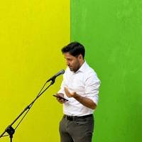
Filiberto Ciaglia
Filiberto Ciaglia (1994) is a postdoctoral researcher in Geography at Sapienza University of Rome, where he earned his PhD in "Documentary, Linguistic and Literary Sciences" in January 2025. Former consultant to the Italian Geographical Society, since 2021 he has contributed as a research collaborator to the international ProSiMo project, conducted in partnership with Roma Tre University and the University of Jaén.
Member of several academic societies, he currently serves as President of the Abruzzo Section of the Italian Association of Geography Teachers and as Auditor of the Italian Centre for Historical-Geographical Studies. Since November 2025, he is also an ordinary member of the Historical Geography Research Group of the Royal Geographical Society.
He delivers supplementary teaching in the university courses Historical Geography and Geography Education (Prof. Riccardo Morri) and collaborates with the Sapienza Geography Museum. His research interests include the historical geography of modern Italy and Europe, the history of travel and exploration, and the study of geo-historical sources. He has published his work in national and international journals and is the author of the book Le ascese al Velino e al Sirente nell’Ottocento. Linee di storia dell’esplorazione appenninica (Kirke, 2022).
Member of several academic societies, he currently serves as President of the Abruzzo Section of the Italian Association of Geography Teachers and as Auditor of the Italian Centre for Historical-Geographical Studies. Since November 2025, he is also an ordinary member of the Historical Geography Research Group of the Royal Geographical Society.
He delivers supplementary teaching in the university courses Historical Geography and Geography Education (Prof. Riccardo Morri) and collaborates with the Sapienza Geography Museum. His research interests include the historical geography of modern Italy and Europe, the history of travel and exploration, and the study of geo-historical sources. He has published his work in national and international journals and is the author of the book Le ascese al Velino e al Sirente nell’Ottocento. Linee di storia dell’esplorazione appenninica (Kirke, 2022).
less
InterestsView All (8)
Uploads
Papers by Filiberto Ciaglia
fallida) del territorio calabrés después del devastador sismo de 1783, se
inscribe en el alcance de los estudios sobre las dificultades a las que
se enfrenta la población local y la clase política del Reino de Nápoles
animada por el reformismo borbónico. Abordada desde una perspectiva
comparativa en el marco del proyecto internacional ProSiMoll la investigación geo-histórica supuso la recuperación de documentos producidos en la época, tras la catástrofe, por las instituciones responsables, y el nuevo estudio de los mismos. La atención prestada a las múltiples cuestiones interconectadas (históricas,
geográficas, cartográficas, culturales, sociales, económicas, políticas,
técnicas y tecnológicas), incitó a los investigadores a reconsiderar
las fuentes y a valorar entre ellas la cartografía histórica, como producto
de conocimientos especializados y palimpsesto de información. Con el
fin de gestionar mejor los datos e interpretarlos después de manera más
específica, la solución identificada condujo a la creación de una base
de datos cualitativa-cuantitativa.
una porzione di valle in un ambiente di lavoro tridimensionale.
group proposed a re-reading of the main historical sources related to the devastating
earthquakes that struck Calabria and Messina in 1783. It aims to answer fundamental
questions which remain unanswered, such as how many communities are affected. Or to pose new research questions around the documentary accounts of the damage and the specific outcomes and processes that resulted from the disaster in individual localities. The essay aims to highlight the fundamental role of geo-historical studies, which process qualitative and descriptive data in order to derive the information used by other disciplines for the realisation of systems that appear highly technological. The contribution of historical cartography was particularly promising and, together with the reinterpretation of descriptive sources, made it possible to identify a good percentage of the affected centres that had escaped the attention of, for example, the INGV’s major project on historical Italian earthquakes (ASMI). These results open up scenarios for comparison and exchange with “hard sciences”, which will be able to acquire the new information in order to proceed with the implementation of their own systems. The research has also led to the creation of two prototype products, a qualitative-quantitative database and a historical webGIS, tools that will allow further research to be carried out. These topics include, for example, the complex relationships between settled communities and their highly seismic territory, the use of resources, the economic, social and administrative dynamics triggered by natural disasters, historical
toponymy and its multiple valences, and the patrimonialisation of historical
landscapes.
anniversario della celebre salita del militare Francesco De Marchi
al Gran Sasso d’Italia, compiuta nel 1573. Sulla scia dell’importanza rivestita da tale ricorrenza nell’opinione pubblica variamente interessata alle tematiche di montagna, si intende operare una riflessione su nuove luci e ombre persistenti attorno alla scalata del militare, interrogativi che accompagnano una pagina affascinante di letteratura di viaggio e si legano a questioni nodali nello studio della scoperta geografica dell’Appennino.