
Forecast
Right Now
- Humidity: 77%
- Cloud Coverage:2%
- Wind: 9 mph
- UV Index: 0 Low
- Sunrise: 05:17:55 AM
- Sunset: 08:33:34 PM
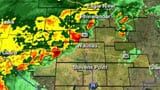
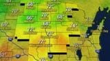
Thunderstorms are now clearing from the area and we will likely see a bit of a cooldown tomorrow. Despite cooler feeling weather, temperatures will remain above average, in the upper 70s. Drier weather is ahead as well with blue skies through the rest of the week. Unlike today and yesterday we shouldn't much of any chance of rainfall for the rest of the week, let alone severe storms.
Tonight: Clearing and cooler.
Low: 51 Wind: NE 5-10
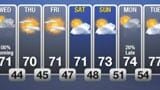
Thursday: Sunny and pleasant
High: 78 Wind: East-Southeast 5-10
Thursday Night: Clear and quiet
Low: 51
Friday: Sunny to partly cloudy and warm with a slight chance of showers in the evening, mainly in the Northwoods.
High: 86
Saturday: Mostly sunny and a bit breezy.
High: 79
Following a stormy evening, we can expect high pressure to settle in, bringing clear skies, light winds, and dry conditions. Daytime temperatures will rise into the upper 70s, creating more comfortable air for many. On Friday, we're looking at mostly sunny skies and warmer temperatures, reaching the 80s. A cold front moving in from the northeast may bring a slight chance of showers late Friday, particularly in the Northwoods, though severe weather doesn't look too likely at the moment.
As the cold front passes, temperatures will dip slightly over the weekend, but still remain above average. Saturday and Sunday should see highs nearing 80 degrees. Expect a bit of a breeze on Saturday, with mainly sunny skies both days.
There might be a slight chance of rain Sunday night, but then we can anticipate partly to mostly sunny conditions returning on Monday and Tuesday, with highs around 80 on Monday and potentially rising to the low 80s on Tuesday and Wednesday.
Have a great rest of the week! Meteorologist Jackson Garlock
On this day in weather history:
1989 — Unseasonably hot weather prevailed in the southeastern U.S. Ten cities reported record high temperatures for the date as readings soared into the 90s. Lakeland, FL, reported a record high of 99 degrees, and Biloxi, MS, reported a temperature of 90 degrees along with a relative humidity of 75 percent. (The National Weather Summary)
1990 — Thunderstorms produced severe weather from north central Texas to the Central Gulf Coast Region. Severe thunderstorms spawned four tornadoes, and there were eighty-one reports of large hail or damaging winds. Late afternoon thunderstorms over southeast Louisiana produced high winds which injured twenty-seven persons at an outdoor music concert in Baton Rouge, and high winds which gusted to 78 mph at the Lake Ponchartrain Causeway. (Storm Data) (The National Weather Summary)
Advanced Tools


Hourly Forecast
Wausau, WI
Wind: ENE @ 9mph
Precip: 1% Chance
Humidity: 73%
Wind Chill: 56°
Heat Index: 58°
UV Index: 0 Low
Visibility: 10 mi
Wind: ENE @ 7mph
Precip: 1% Chance
Humidity: 69%
Wind Chill: 54°
Heat Index: 56°
UV Index: 0 Low
Visibility: 10 mi
Wind: ENE @ 7mph
Precip: 1% Chance
Humidity: 69%
Wind Chill: 52°
Heat Index: 54°
UV Index: 0 Low
Visibility: 10 mi
Wind: ENE @ 7mph
Precip: 1% Chance
Humidity: 65%
Wind Chill: 52°
Heat Index: 54°
UV Index: 0 Low
Visibility: 10 mi
Wind: ENE @ 6mph
Precip: 2% Chance
Humidity: 70%
Wind Chill: 50°
Heat Index: 52°
UV Index: 0 Low
Visibility: 10 mi
Wind: ENE @ 6mph
Precip: 2% Chance
Humidity: 73%
Wind Chill: 48°
Heat Index: 51°
UV Index: 0 Low
Visibility: 10 mi
Wind: ENE @ 5mph
Precip: 2% Chance
Humidity: 75%
Wind Chill: 48°
Heat Index: 50°
UV Index: 0 Low
Visibility: 10 mi
Wind: ENE @ 6mph
Precip: 3% Chance
Humidity: 72%
Wind Chill: 50°
Heat Index: 52°
UV Index: 0 Low
Visibility: 10 mi
Wind: E @ 8mph
Precip: 2% Chance
Humidity: 67%
Wind Chill: 53°
Heat Index: 55°
UV Index: 1 Low
Visibility: 10 mi
Wind: E @ 8mph
Precip: 1% Chance
Humidity: 61%
Wind Chill: 56°
Heat Index: 58°
UV Index: 3 Moderate
Visibility: 10 mi
Wind: E @ 7mph
Precip: 0% Chance
Humidity: 55%
Wind Chill: 60°
Heat Index: 61°
UV Index: 4 Moderate
Visibility: 10 mi
Wind: E @ 6mph
Precip: 0% Chance
Humidity: 50%
Wind Chill: 64°
Heat Index: 64°
UV Index: 6 High
Visibility: 10 mi
7-Day Forecast
Wausau, WI
Chance of Precip: 2%
Sunrise: 05:17:55 AM
Sunset: 08:33:34 PM
Humidity: 71%
Wind: ENE @ 9mph
UV Index: 0 Low
Wednesday Night
A clear sky. Low around 50F. Winds ENE at 5 to 10 mph.
Chance of Precip: 3%
Sunrise: 05:17:13 AM
Sunset: 08:34:30 PM
Humidity: 47%
Wind: ESE @ 8mph
UV Index: 8 Very High
Thursday Night
Mostly clear. Low around 50F. Winds light and variable.
Chance of Precip: 4%
Sunrise: 05:16:33 AM
Sunset: 08:35:25 PM
Humidity: 45%
Wind: WSW @ 5mph
UV Index: 8 Very High
Friday Night
Partly cloudy skies. Low 57F. Winds ENE at 5 to 10 mph.
Chance of Precip: 2%
Sunrise: 05:15:56 AM
Sunset: 08:36:19 PM
Humidity: 40%
Wind: ESE @ 12mph
UV Index: 7 High
Saturday Night
Partly cloudy. Low 49F. Winds E at 10 to 15 mph.
Chance of Precip: 3%
Sunrise: 05:15:20 AM
Sunset: 08:37:11 PM
Humidity: 40%
Wind: S @ 5mph
UV Index: 8 Very High
Sunday Night
Generally fair. Low 54F. Winds light and variable.
Chance of Precip: 11%
Sunrise: 05:14:47 AM
Sunset: 08:38:02 PM
Humidity: 39%
Wind: ENE @ 7mph
UV Index: 8 Very High
Monday Night
Partly cloudy skies. Low 52F. Winds ENE at 5 to 10 mph.
Chance of Precip: 3%
Sunrise: 05:14:16 AM
Sunset: 08:38:51 PM
Humidity: 37%
Wind: ENE @ 7mph
UV Index: 8 Very High
Tuesday Night
Partly cloudy skies. Low around 55F. Winds SE at 5 to 10 mph.