Thank you for visiting nature.com. You are using a browser version with limited support for CSS. To obtain
the best experience, we recommend you use a more up to date browser (or turn off compatibility mode in
Internet Explorer). In the meantime, to ensure continued support, we are displaying the site without styles
and JavaScript.
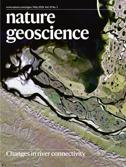
The exchange between river channels and their surrounding floodplains — surface water connectivity — regulates global water cycles, biogeochemical fluxes, geomorphology and ecosystem health. Feng and colleagues find, by analysing satellite-based records over the past four decades, a net global increase in connectivity, driven by climate and anthropogenic changes and shaping sediment transport.
Earth’s landmass has been sculpted by rivers for millions of years. Humans are now reshaping these landscapes as engineered modifications and the impacts of anthropogenic climate change alter river connectivity, water resources, and sediment transport.
Mine waste mining can aid the clean-up of hazardous materials and environmental restoration, alongside economic benefits. Success is dependent upon understanding the heterogeneous nature of these deposits, economic modelling to generate investor confidence, and robust leadership and collaboration to ensure strong regulations and social acceptance.
Geological maps are integral to understanding the Earth and other rocky planetary bodies. As technological advances enable the geological mapping of extreme terrestrial and planetary environments, we must strengthen collaboration, standardization and data accessibility to ensure that the knowledge gained is cohesive, shareable and interoperable.
Ecosystems on land take up roughly a quarter of the carbon emitted through fossil fuel use, but a global analysis of carbon flux measurements indicates that the increase in photosynthetic uptake by drylands is slowing, thereby limiting their potential to mitigate climate change.
Models have long predicted, and satellites have observed, stratospheric cooling from rising anthropogenic carbon dioxide, yet its magnitude and structure have lacked a robust theoretical explanation — until now.
The Southern Ocean is a globally significant carbon sink and carbon cycling in this region drives global biological productivity. Measurements of oxygen in the overlying atmosphere shed light on the Southern Ocean carbon cycle and improve our ability to predict how it will respond to future climate change.
Coesite forms only at extreme pressures. Remziye Akdoğan explains how its presence in continental metamorphic rocks records deep subduction and exhumation.
Radar swath imagery has been used to identify subglacially sourced debris in dozens of structures within the Greenland Ice Sheet. Some debris-rich horizons (termed ‘debris trains’) extend more than 1,000 m off the ice sheet bed. Debris trains are likely to form during terrestrial ice sheet readvance, when the warm core of a relict ice sheet interacts with its new, thin, frozen margin.
An integrated thermomechanical modelling and experimental approach revealed that post-collisional, calc-alkaline magmas result from the mechanical hybridization of relaminated continental crust and mantle peridotite. This interaction has contributed to crustal evolution since the Archaean.
Higher carbon dioxide levels widen the part of the heat spectrum that can emit energy to space, cooling the stratosphere and strengthening the warming effect of this gas, according to idealized spectroscopy and radiative transfer model simulations.
Coastal ocean warming drives the recent increase in large-scale aggregation of humid heatwaves, accounting for up to two-thirds of their rising frequency and spatial extent, according to climate reanalyses and model simulations from 1982–2023.
Changes in Southern Ocean circulation have preceded shifts in the Atlantic Meridional Overturning Circulation in the North Atlantic over the past 1,300 years, according to an analysis of bamboo coral records from the southwest Pacific.
A deep learning framework called GOFLOW enables observation, and may ultimately improve forecasting of, oceanic surface currents down to submesoscale spatial and temporal resolutions from thermal imagery routinely collected by geostationary satellites.
Atmospheric oxygen sampling provides improved estimates of Southern Ocean net primary productivity, revealing that many Earth system models underestimate productivity in ways that bias both present-day and future projections of air–sea CO2 exchange.
Machine learning upscaling analyses of global FLUXNET carbon and water flux measurements indicate that dryland vegetation productivity showed a negligible increase between 1982–2000 and 2001–2022, whereas humid-region vegetation productivity exhibited a nearly constant increase.
Snow loss and warming reduce runoff and alter the relative contributions of old and young groundwater to streamflow in the Upper Colorado River Basin headwaters, according to a data–model analysis.
The flow of water between rivers and floodplains—surface water connectivity—showed a net global increase from 1984 to 2019 driven by climate and anthropogenic changes and shaping sediment transport, according to a study of satellite observations.
The total sediment flux from land to the ocean across the pan-Arctic has risen by 15% since 1980, driven by greater river discharge, intensified thermokarst disturbances and wildfire activity, according to machine learning and satellite-based reconstructions of suspended sediment dynamics in 4,331 river reaches.
Englacial structures in the Greenland Ice Sheet contain debris lifted hundreds of metres into the ice column, likely forming as the expanding ice sheet overrode its frozen margin following the last interglacial, according to 3D airborne radar imaging.
Atmospheric circulation patterns and mean climate conditions lead to heterogeneity in water isotope–temperature relationships across Antarctica, and accounting for these effects allows for more robust interpretation of temperature proxy records from ice cores.
Post-collisional calc-alkaline magmatism has originated from the mixing and hybridization of relaminated continental crust and mantle peridotite since the Archaean, according to numerical simulations of continental subduction and melting experiments.