Log InRegister
Quick Links : The Mindat ManualThe Rock H. Currier Digital LibraryMindat Newsletter [Free Download]
Home PageAbout MindatThe Mindat ManualHistory of MindatCopyright StatusWho We AreContact UsAdvertise on Mindat
Donate to MindatCorporate SponsorshipSponsor a PageSponsored PagesMindat AdvertisersAdvertise on Mindat
Learning CenterWhat is a mineral?The most common minerals on earthInformation for EducatorsMindat ArticlesThe ElementsThe Rock H. Currier Digital LibraryGeologic Time
Minerals by PropertiesMinerals by ChemistryMineral Visual ExplorerAdvanced Locality SearchRandom MineralRandom LocalitySearch by minIDLocalities Near MeSearch ArticlesSearch GlossaryMore Search Options
The Mindat ManualAdd a New PhotoRate PhotosLocality Edit ReportCoordinate Completion ReportAdd Glossary Item
Mining CompaniesStatisticsUsersMineral MuseumsClubs & OrganizationsMineral Shows & EventsThe Mindat DirectoryDevice SettingsThe Mineral QuizTime Machine
Photo SearchPhoto GalleriesSearch by ColorPhoto Colour ExplorerNew Photos TodayNew Photos YesterdayMembers' Photo GalleriesPast Photo of the Day GalleryPhotography

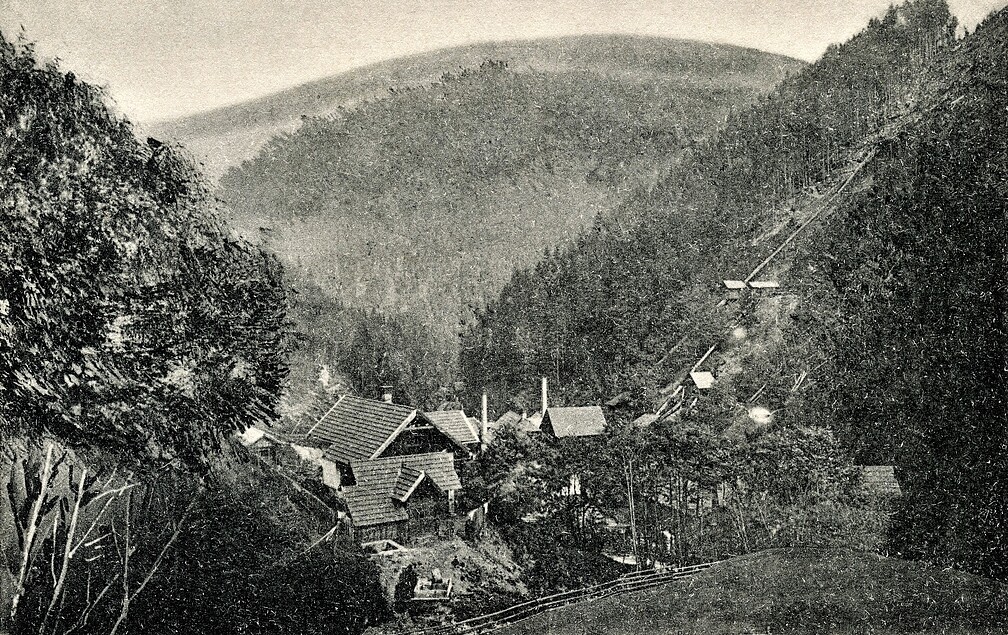
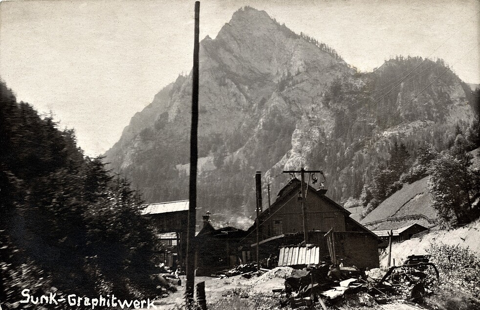
Graphite mine, Sunk, Hohentauern, Murtal District, Styria, Austriai
Regional Level Types
Graphite mineMine
SunkMining Area
HohentauernMunicipality
Murtal DistrictDistrict
StyriaState
AustriaCountry

This page is currently not sponsored. Click here to sponsor this page.
07979860017272083244981.jpg
View of the Sunk graphite mining area, ca. 1905.

Graphite mine, Sunk, Hohentauern, Murtal District, Styria, Austria
08590190017272083257497.jpg
View of the Sunk graphite mining area, ca. 1924.

Graphite mine, Sunk, Hohentauern, Murtal District, Styria, Austria
07979860017272083244981.jpg
View of the Sunk graphite mining area, ca. 1905.

Graphite mine, Sunk, Hohentauern, Murtal District, Styria, Austria
08590190017272083257497.jpg
View of the Sunk graphite mining area, ca. 1924.

Graphite mine, Sunk, Hohentauern, Murtal District, Styria, Austria
07979860017272083244981.jpg
View of the Sunk graphite mining area, ca. 1905.

Graphite mine, Sunk, Hohentauern, Murtal District, Styria, Austria
08590190017272083257497.jpg
View of the Sunk graphite mining area, ca. 1924.

Graphite mine, Sunk, Hohentauern, Murtal District, Styria, Austria
Latitude & Longitude (WGS84):
47° 27' 51'' North , 14° 28' 42'' East
Latitude & Longitude (decimal):
Type:
Köppen climate type:
Nearest Settlements:
PlacePopulationDistance
Schwarzenbach184 (2018)2.3km
Trieben2,408 (2018)2.5km
Hohentauern327 (2018)3.5km
Sankt Lorenzen im Paltental306 (2018)3.9km
Dietmannsdorf bei Trieben492 (2018)4.3km
Nearest Clubs:
Local clubs are the best way to get access to collecting localities
ClubLocationDistance
Vereinigung der Leobener MineralienfreundeSt. Marein-Feistritz, Styria38km
Mindat Locality ID:
57607
Long-form identifier:
mindat:1:2:57607:4
GUID (UUID V4):
0
Name(s) in local language(s):
Graphitgrube, Sunk, Hohentauern, Niedere Tauern, Steiermark, Österreich


Larger graphite mining area, active 1871-1993.
34 adits, 4 dumps (at an altitude of 920-1300 m) according to IRIS database.
Coordinates are those of a larger dump.

Located near Sunk.

Upper Carboniferous graphite layers hosted in phyllite and quartzite.

Select Mineral List Type

Standard Detailed Gallery Strunz Chemical Elements

Mineral List


1 valid mineral.

Gallery:

List of minerals arranged by Strunz 10th Edition classification

Group 1 - Elements
Graphite1.CB.05aC

List of minerals for each chemical element

CCarbon
C GraphiteC

Other Regions, Features and Areas containing this locality

Austria
Eurasian PlateTectonic Plate
  • AlpsAccretionary Complex
EuropeContinent

This page contains all mineral locality references listed on mindat.org. This does not claim to be a complete list. If you know of more minerals from this site, please register so you can add to our database. This locality information is for reference purposes only. You should never attempt to visit any sites listed in mindat.org without first ensuring that you have the permission of the land and/or mineral rights holders for access and that you are aware of all safety precautions necessary.

References

 
Mindat.org® is an outreach project of the Hudson Institute of Mineralogy, a 501(c)(3) not-for-profit organization. Mindat® and mindat.org® are registered trademarks of the Hudson Institute of Mineralogy.
Copyright © mindat.org and the Hudson Institute of Mineralogy 1993-2026, except where stated. Most political location boundaries are © OpenStreetMap contributors. Mindat.org relies on the contributions of thousands of members and supporters. Founded in 2000 by Jolyon Ralph and Ida Chau.
To cite: Ralph, J., Von Bargen, D., Martynov, P., Zhang, J., Que, X., Prabhu, A., Morrison, S. M., Li, W., Chen, W., & Ma, X. (2025). Mindat.org: The open access mineralogy database to accelerate data-intensive geoscience research. American Mineralogist, 110(6), 833–844. doi:10.2138/am-2024-9486.
Privacy Policy - Terms & Conditions - Contact Us / DMCA issues - Report a bug/vulnerability Current server date and time: May 19, 2026 01:14:41 Page updated: November 28, 2025 19:03:39
Go to top of page