Chardonnet pass, Chamonix, Chamonix-Mont-Blanc, Bonneville, Haute-Savoie, Auvergne-Rhône-Alpes, Francei
| Regional Level Types | |
|---|---|
| Chardonnet pass | Pass |
| Chamonix | Village |
| Chamonix-Mont-Blanc | Commune |
| Bonneville | Arrondissement |
| Haute-Savoie | Department |
| Auvergne-Rhône-Alpes | Region |
| France | Country |
This page is currently not sponsored. Click here to sponsor this page.

Latitude & Longitude (WGS84):
45° 58' 4'' North , 7° 0' 29'' East
Latitude & Longitude (decimal):
Type:
Köppen climate type:
Other/historical names associated with this locality:
Rhône-Alpes
Name(s) in local language(s):
Col du Chardonnet, Massif du Mont Blanc,
Old graphite mines.
Thermal metamorphism of carboniferous rocks lenses by microgranites.
Select Mineral List Type
Standard Detailed Gallery Strunz Chemical ElementsCommodity List
This is a list of exploitable or exploited mineral commodities recorded at this locality.Mineral List
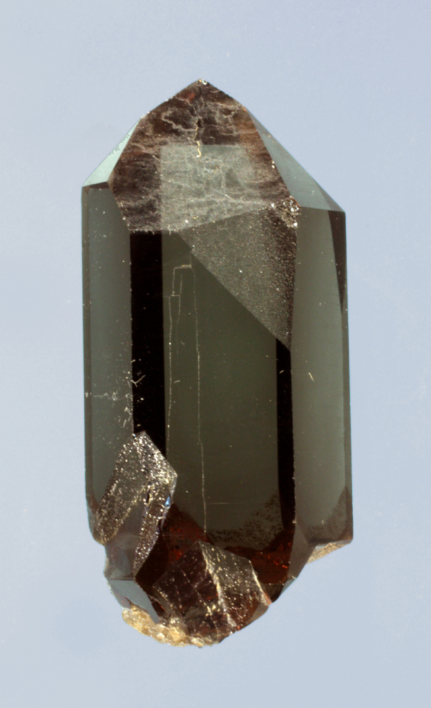
1 valid mineral.
Gallery:
Other Regions, Features and Areas containing this locality
Eurasian PlateTectonic Plate
- AlpsAccretionary Complex
EuropeContinent
- The AlpsMountain Range
- Mont Blanc MassifMassif
France
- Auvergne-Rhône-Alpes
This page contains all mineral locality references listed on mindat.org. This does not claim to be a complete list. If you know of more minerals from this site, please register so you can add to our database. This locality information is for reference purposes only. You should never attempt to
visit any sites listed in mindat.org without first ensuring that you have the permission of the land and/or mineral rights holders
for access and that you are aware of all safety precautions necessary.
Chardonnet pass, Chamonix, Chamonix-Mont-Blanc, Bonneville, Haute-Savoie, Auvergne-Rhône-Alpes, France