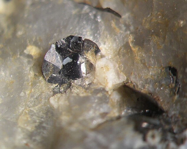
Hohenwarther Höhe graphite mine, Hohenwarth, Dunkelsteinerwald, Melk District, Lower Austria, Austriai
| Regional Level Types | |
|---|---|
| Hohenwarther Höhe graphite mine | Mine |
| Hohenwarth | - not defined - |
| Dunkelsteinerwald | Municipality |
| Melk District | District |
| Lower Austria | State |
| Austria | Country |
This page is currently not sponsored. Click here to sponsor this page.
Latitude & Longitude (WGS84):
48° 15' 53'' North , 15° 24' 45'' East
Latitude & Longitude (decimal):
Type:
Köppen climate type:
Nearest Settlements:
| Place | Population | Distance |
|---|---|---|
| Gerolding | 246 (2018) | 1.7km |
| Schönbühel an der Donau | 317 (2018) | 3.2km |
| Aggsbach Dorf | 399 (2018) | 3.2km |
| Aggsbach | 391 (2018) | 3.3km |
| Grimsing | 138 (2018) | 3.8km |
Name(s) in local language(s):
Hohenwarther Höhe, Hohenwarth, Dunkelsteinerwald, Dunkelsteinerwald, Mostviertel, Niederösterreich, Österreich
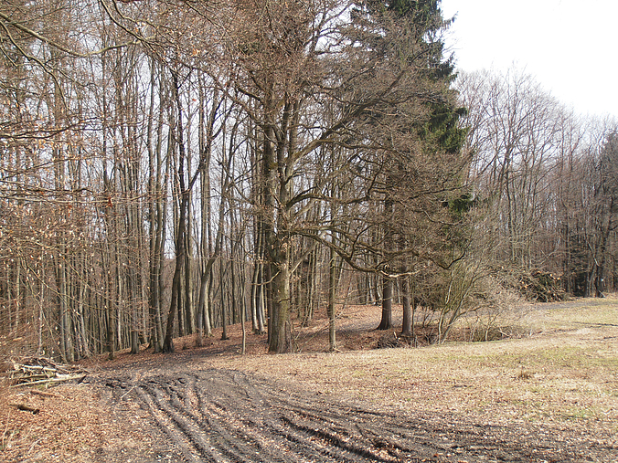
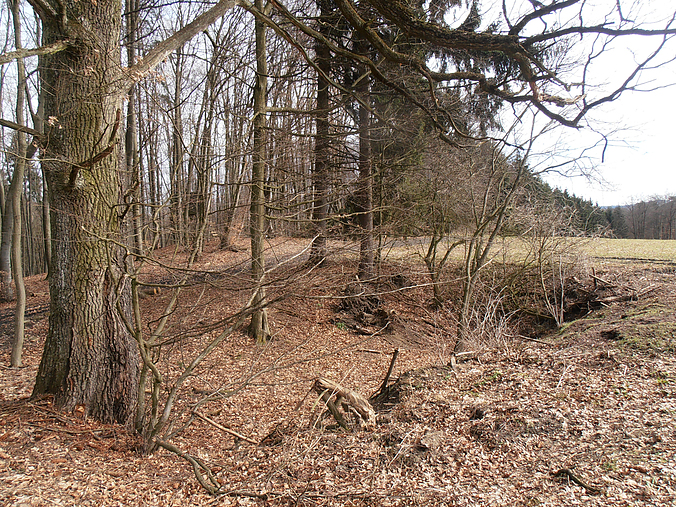
Abandoned small graphite mine.
Several very small excavations ('Pingen') can be seen on the LIDAR map.
Select Mineral List Type
Standard Detailed Gallery Strunz Chemical Elements
Other Regions, Features and Areas containing this locality
Austria
- Lower Austria
- DunkelsteinerwaldForest
- Melk District
- ⭔MostviertelQuarter
Eurasian PlateTectonic Plate
- Rheno-Hercynian BeltOrogenic Belt
EuropeContinent
- Bohemian MassifMassif
This page contains all mineral locality references listed on mindat.org. This does not claim to be a complete list. If you know of more minerals from this site, please register so you can add to our database. This locality information is for reference purposes only. You should never attempt to
visit any sites listed in mindat.org without first ensuring that you have the permission of the land and/or mineral rights holders
for access and that you are aware of all safety precautions necessary.
Hohenwarther Höhe graphite mine, Hohenwarth, Dunkelsteinerwald, Melk District, Lower Austria, Austria