Abilene Area Reservoirs: Monitored Water Supply Reservoirs are 43.9% full on 2026-08-24
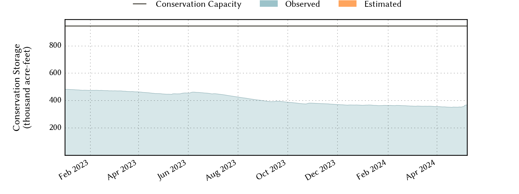
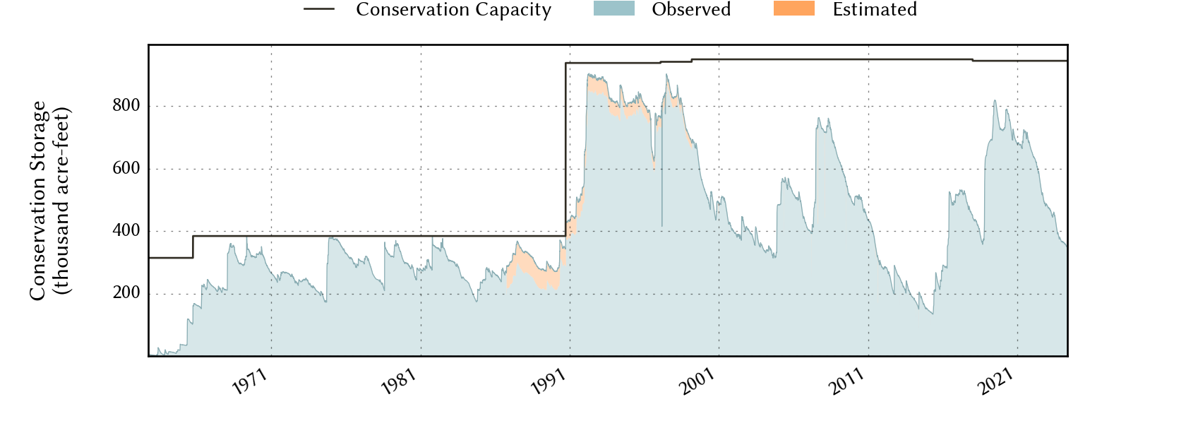
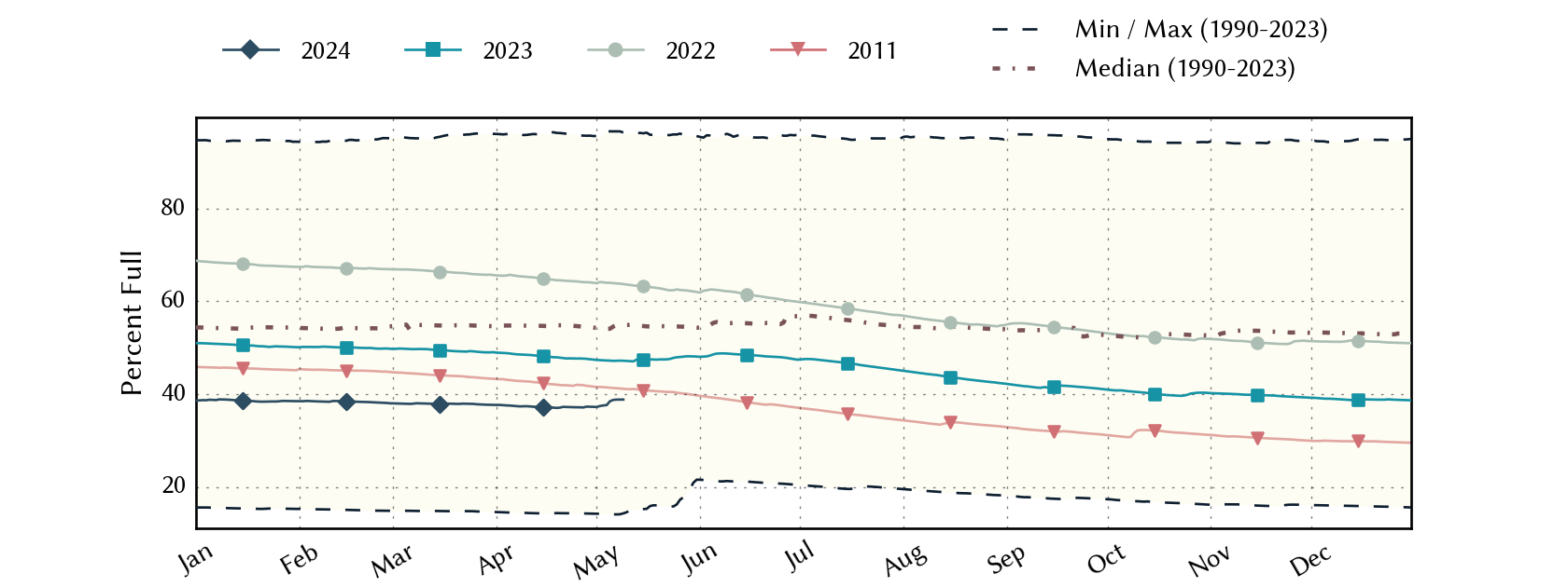
Historical Data
| Date | Percent Full |
Reservoir Storage (acre-ft) |
Conservation Storage (acre-ft) |
Conservation Capacity (acre-ft) |
|
|---|---|---|---|---|---|
| Today | 2026-08-24 | 43.9 | 420,382 | 415,500 | 945,568 |
| Yesterday | 2026-08-23 | 44.0 | 421,050 | 416,168 | 945,568 |
| 2 days ago | 2026-08-22 | 44.1 | 421,832 | 416,950 | 945,568 |
| 1 week ago | 2026-08-17 | 44.5 | 426,025 | 421,143 | 945,568 |
| 1 month ago | 2026-07-24 | 46.8 | 447,343 | 442,461 | 945,568 |
| 3 months ago | 2026-05-24 | 48.3 | 461,720 | 456,838 | 945,568 |
| 6 months ago | 2026-02-24 | 46.2 | 442,202 | 437,320 | 945,568 |
| 1 year ago | 2025-08-24 | 53.1 | 507,074 | 502,192 | 945,568 |
*
Percent Full is based on Conservation Storage and Conservation Capacity and doesn't account for storage in flood pool.
Area Map

Reservoir Storage
| Reservoir | Type | Percent Full |
Water Level (ft) |
Height Above Conservation Pool (ft) |
Reservoir Storage (acre-ft) |
Conservation Storage (acre-ft) |
Conservation Capacity (acre-ft) |
Surface Area (acres) |
|---|---|---|---|---|---|---|---|---|
| Abilene |

|
10.5 | 1,993.05 | -19.25 | 826 | 826 | 7,900 | 158 |
| Fort Phantom Hill |
|
70.8 | 1,630.01 | -5.89 | 49,592 | 49,586 | 70,030 | 3,075 |
| Hubbard Creek |
|
38.4 | 1,167.01 | -16.30 | 125,176 | 120,300 | 313,298 | 8,300 |
| O H Ivie |
|
44.2 | 1,530.74 | -20.76 | 244,788 | 244,788 | 554,340 | - n.a. - |