
Why the 40 Quay “Monitor Point” Proposal is Bad for the Inlet, the Park, and the Neighborhood
This is a giveaway of public land to a private developer proposing three luxury towers 21, 41 and 56 stories tall just 50 feet from the shoreline of Bushwick Inlet, one of the East River’s only natural tidal estuaries.
This land belongs to the public and must serve the public good, not private luxury development.
Open Space
Developer Claim
The developer’s plan will create 50,000 square feet of new open space.
Fact
These items, an upland connector and a waterfront public access area, are zoning requirements per the local Waterfront Access Plan, not sweeteners that the developer is adding in.
They essentially are a street extension and a esplanade comprised mostly of hardscape, not actual parkland with athletic fields & courts, play areas, lawns and gardens.
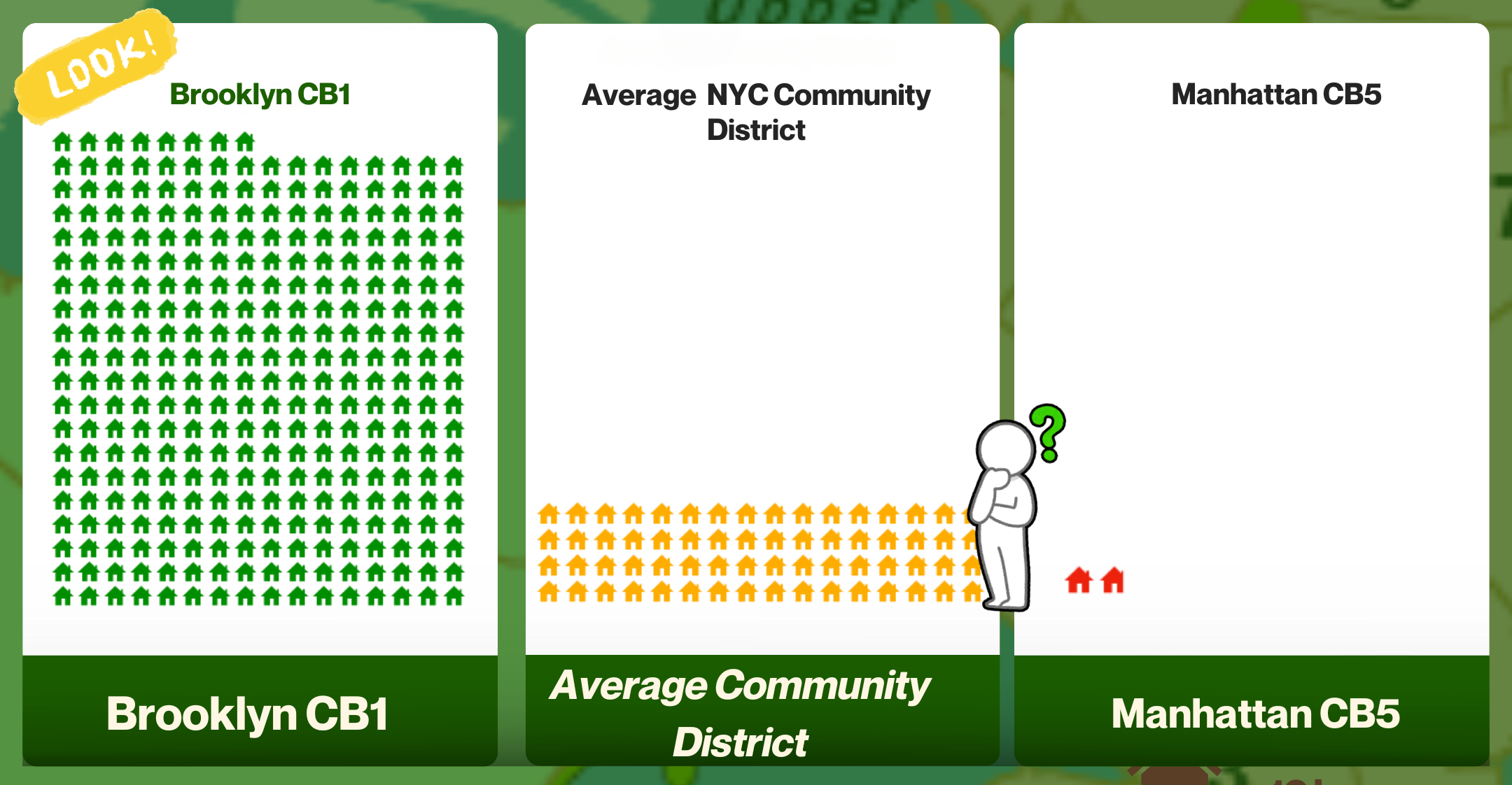
Per the City’s environmental review standards (CEQR), neighborhoods should have 2.5 acres of open space per 1,000 people. The city average is 1.8 acres, and Greenpoint-Williamsburg is a miserable 0.6 acres. Using this metric, the developer should be creating 300,000 square feet of new open space to accommodate the almost 3,000 new residents their proposed buildings will bring in. (see the open space ratio graphic below, using square feet/person metric)
Affordable Housing
Developer Claim
The developer’s plan will include 25% affordable housing units in their buildings.
Fact
This item is the minimum quantity required by the City’s zoning resolution. It’s not being included voluntarily.
New building on PUBLIC LAND should be 100% affordable, not simply 25%.
Because so much luxury housing stock is being added (862 units planned from Monitor Point) to the local and citywide housing supply, Average Median Income, which determines affordable housing rental rates, has been steadily rising.
79 Quay Street across from 40 Quay, is listing an apartment for $13,500/month. This market speculation in trending way up on the North Brooklyn waterfront.
Ultra-luxury housing, that Monitor Point plans to develop, will worsen the housing crisis for 90% of the population who cannot even come close to affording rent at that level.
Parks and Housing
Developer Claim
New York City and Brooklyn are facing an unprecedented housing crisis that requires creative solutions like Monitor Point.
Fact
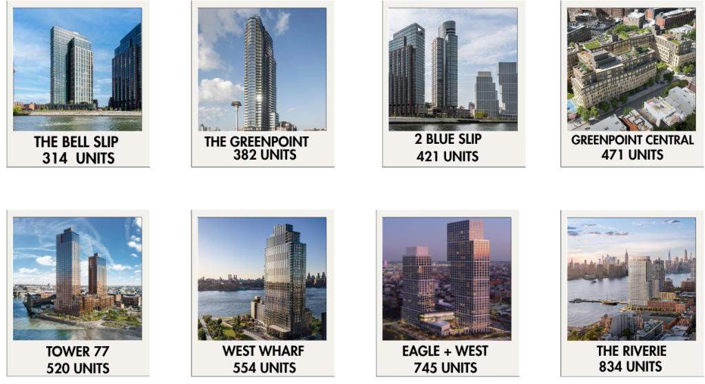
Over 29,000 new units built in our district, the most of any neighborhood in NYC for the last 14 years. (see text and charts below)
Both City Hall and the Brooklyn Borough President have stated that robust housing development must happen in underperforming home construction districts and outside overwhelmed districts such as ours.
We have delivered enough housing and have been shortchanged on parks, which is critical infrastructure in itself serving the health and well being of New Yorkers and providing climate resiliency.
In North Brooklyn promised Bushwick Inlet and Box Street Parks have not been delivered after 20 years and counting, 22 acres worth.
See the Open Space fact for more on that subject.
Neighborhood Character
Developer Claim
Monitor Point was specifically designed to respect Greenpoint’s unique character.
Fact
Greenpoint’s charm lies in the abundance of low-rise historic brick and limestone rowhouses constructed in the latter half of the 19th century, along with converted warehouses and light manufacturing buildings from the same era.
Monitor Point’s building plan will result in almost 1.2 million square feet of steel, concrete and glass, towering well above the existing towers on the Greenpoint waterfront. This design will double down on the assault on the unique village character of Greenpoint, anything but respectful.
The current low-density zoning from 2005 for the site (R6) was meant to protect the park and residential blocks nearby. Along the western waterfront on West Street high density (R8) was assigned to those properties and R6 was designated along the street containing building height limits, to provide a sensitive transition across West Street and Quay Street, which promotes good urban design.
Removal of Parkland
Developer Claim
Monitor Point will preserve local heritage through the Greenpoint Monitor Museum.
Fact
To pay for the museum the developer is planning to have the park designation from the adjoining property at 56 Quay Street removed to enable them to acquire air rights for use at 40 Quay Street. This site was orignally planned to be a part of Bushwick Inlet Park.
This action and purchase will result in over 300,000 square feet of additional development rights for the Monitor Point building complex, creating tremendously out of scale towers and luxury apartments mostly for the wealthiest 10% of the population.
Effect on Ecology
Fact
Monitor Point threatens a rare ecological treasure—Bushwick Inlet is a vital natural habitat in NYC’s harbor and home to diverse wildlife.
Bushwick Inlet is a rare natural embayment, a migratory bird stop, and an ecological treasure opening to the public for the first time in over 100 years.
So close to the water’s edge, the towers pose a direct threat to wildlife and the natural sanctuary of the Inlet, reducing it to a mere water feature amenity within the huge development. More than 80% of our marine life health depend on estuaries like the Bushwick Inlet.
Built within a 100-year flood zone, a massive skyscraper will work against nature-based flood defenses that would best protect the neighborhood.
Flood Risk
Developer Claim
Coastal resilience is central to their design.
Fact
Being that the 40 Quay Street property is adjacent to Bushwick Inlet, it resides squarely inside 100-year and 500-year flood zones. Storm surges and flooding from increasingly severe storm events put potential residents who may live on this property in the middle of harm’s way and an evacuation zone. (see map screen below)
Monitor Point is required to elevate the 40 Quay Street property up to federal and city levels. Still, the probability that this site will flood during extreme rain events is high. Knowingly locating thousands of residents there seems reckless.
Additionally, relocating existing MTA infrastructure from 2 sections of a coastal flood zone to another one near sewage-inundated and superfund-designated Newtown Creek, also seems reckless and defies common sense.
Neighborhood Improvement
Developer Claim
The plan with support a fairer, more affordable Greenpoint.
Fact
A plan for building a horribly oversized complex creating the tallest towers and apartments for the wealthiest minority in a neighborhood already overwhelmed by towers and tens of thousands of new apartments mostly for that minority, which will degrade the character of our neighborhood further, will create anything but a fairer Greenpoint.
Transparency
Missing From the Developer
Full detailed renderings of the planned Monitor Point buildings are conspicuously absent from presentations and the project website.
Fact
To have a honest good-faith discussion about the plan, the community should have access to complete visualizations of the towers.
This is the elephant in the room that must be discussed in conjunction with everything else. The size and scale of the project is critical to the conversation. Let us see it fully and talk about it.
To be fair is to be fully transparent with the development plans.
Greenpoint-Williamsburg (BK01) had the most new housing units in New York City over the last decade.
“Some neighborhoods got away with contributing no new affordable housing,” said (Brooklyn Borough President) Reynoso. “Between 2010 and 2020, Community Board 1 — which encompasses Greenpoint and Williamsburg — added 18,500 units of a housing, while Community District 18 — which encompasses Canarsie, Bergen Beach, Mill Basin, Flatlands, Marine Park, Georgetown, and Mill Island — only added 500 units.”

NYC Planning, 2010-2024
New Homes Built in 2024 – illustrated another way
New Homes Built in 2024 by Community District, from Open New York.
Open Space Ratio
NYC’s Open Space Ratio, square feet of park per person based on CEQR (City Environmental Quality Review).
If upzoned, the 40 Quay mega-development will bring in almost 3,000 new residents while adding almost no additional open space, as the hardscape for the Quay St-BIP connector and the narrow waterfront public access area they are proposing are very small in area and are zoning requirements.

A Threat to Brooklyn’s Climate Resilience
40 Quay Street sits well within the 100-year and 500-year flood zones.
Eliminating this land for new building threatens the soft shorelines necessary to combat the rising sea levels.
Continuing to protect this public land could create ~250 acres of protection from major floods.

Examples of Nature-based
Resiliency Solutions Across NYC

Examples of where the City has succeeded at creating nature-based resiliency solutions to protect both the ecosystem and provide protection for the shorelines. All boroughs should receive adequate protection against the rising water levels, no matter their zip code or community district.