
URGENT! The Monitor Point Rezoning Is In Progress!

We’re in phase 4 of the ULURP process:
The New York City Council
and Local Rep Lincoln Restler
On Wednesday, May 27, 2026, a huge group of folks testified in person and online- THANK YOU!
You have the chance to submit your testimony 72 hours from the hearing date (it’s due Friday, May 29)
Click: E-mail your testimony to City Council & Council Member Restler NOW (Due before 4PM on Friday, May 29)
(or copy & paste these addresses into an email: landusetestimony@council.nyc.gov, District33@council.nyc.gov – subject: Monitor Point)
Submission deadline is FRIDAY, MAY 29, 4:00 PM
Read STI documents submitted to the City Planning Commission (May 2026)
New to Save the Inlet?
Thanks for being here and fighting for the Inlet! Our digital, vintage newspaper, “The Daily Inlet,” will catch you up.
Why are we sounding the
alarm about this plan?
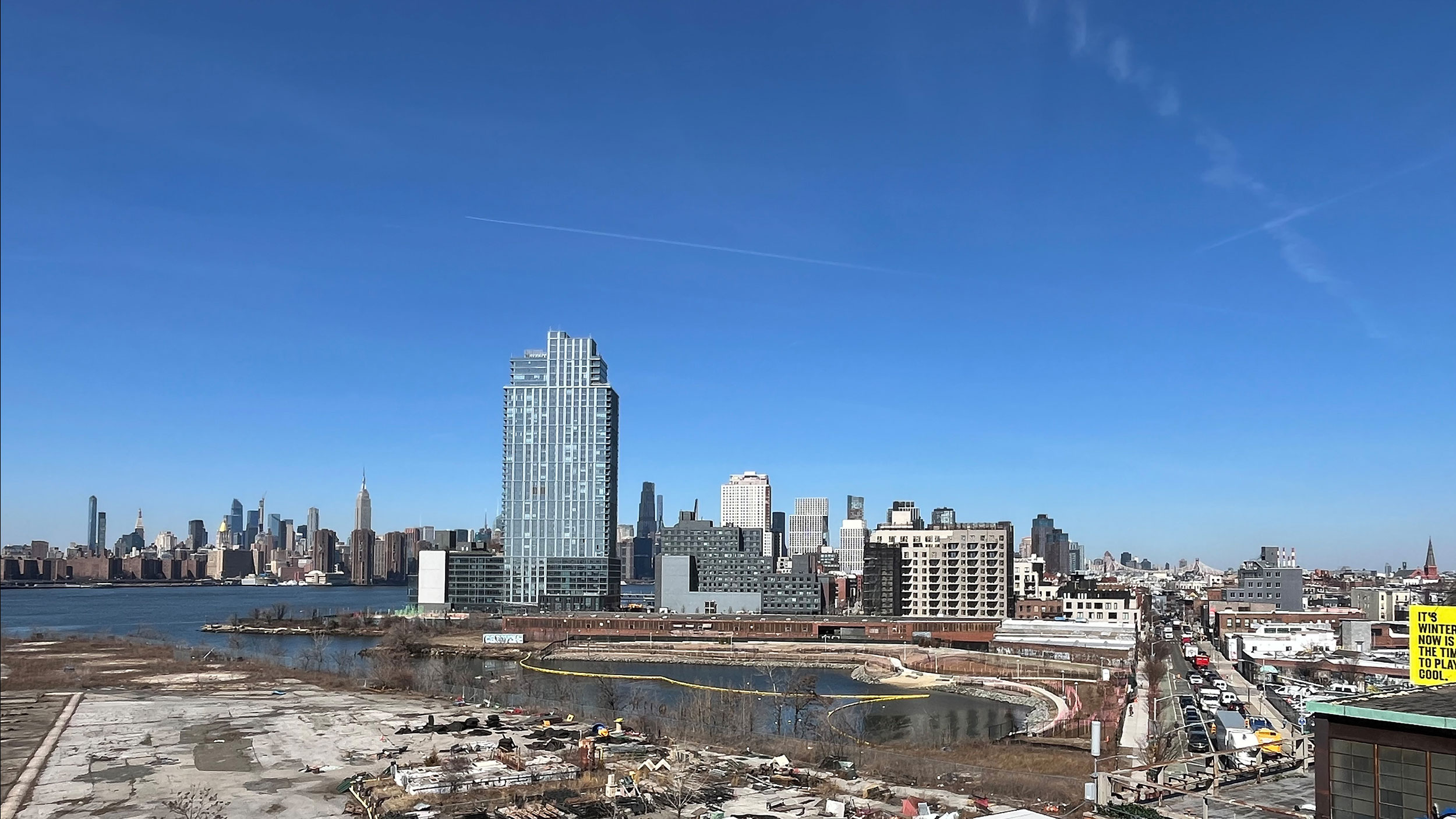
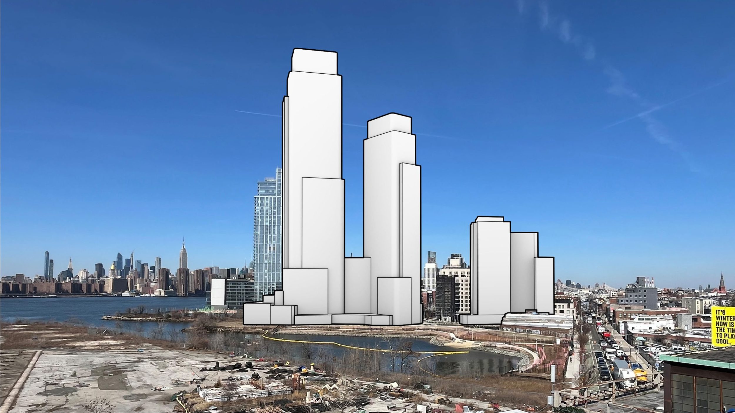
Monitor Point development at 40 Quay Street, conceptualized based on illustrations presented by the developers, using Google Earth and ChatGPT, with Bushwick Inlet Park (under construction) at its foot. As a reference, the tall blue West Wharf tower behind 40 Quay Street is 400′ (39 stories) tall, and the Monitor Point towers, as planned, are to stand 640′ (56 stories), 490′ (41 stories), and 260′ (21 stories) tall.
Talking Points – Why This Plan is Bad and Should Be Defeated
- Violates the 2005 rezoning agreement, which promised this land would serve as a buffer and transition zone—not high-rise towers.
- Steals parkland by requesting the city to remove park designation from an adjoining property to allow high-rise towers.
- Ruins Bushwick Inlet just as the surrounding park is being completed (after 20 years!) by turning the park and Inlet into luxury amenities for luxury tenants.
- Offers inadequate public benefits—just a narrow walkway and street extension—while adding nearly 3,000 new residents.
- Luxury housing accelerates displacement, raises rents, and has failed to make communities, including ours, more affordable. Instead, it’s created inequity.
- Threatens a rare ecological treasure—Bushwick Inlet is a vital natural habitat in NYC’s harbor and home to diverse wildlife.
- Adds 1,200 mostly luxury units to an overbuilt neighborhood with many more towers planned and without any infrastructure upgrades to support the increased density.
- Irresponsible planning that adds thousands of units to a coastal flood zone and devastates resiliency during a climate emergency.

Bushwick Inlet is a rare natural embayment, a migratory bird stop, and an ecological treasure opening to the public for the first time in over 100 years.
So close to the water’s edge, the towers pose a direct threat to wildlife and the Inlet’s natural sanctuary, reducing it to a mere water-feature amenity within the huge development. More than 80% of our marine life’s health depends on estuaries like the Bushwick Inlet.
Built within a 100-year flood zone, a massive skyscraper would undermine nature-based flood defenses that would best protect the neighborhood.
Meet the New Inlet Park at 1 Franklin St
For the first time in over 75 years, the public has access to Bushwick Inlet via the newest addition to Bushwick Inlet Park: the Inlet.
Located at 1 Franklin St, Brooklyn, NY, you’ll find panoramic views of the Bushwick Inlet meeting the East River and Manhattan skyline. A soft beach– already home to nesting shorebirds and Diamondback Terrapins, a vacant Osprey nest platform, walking pathways along the waterfront, blooming plant-life, and two wildlife scopes. This is YOUR park!

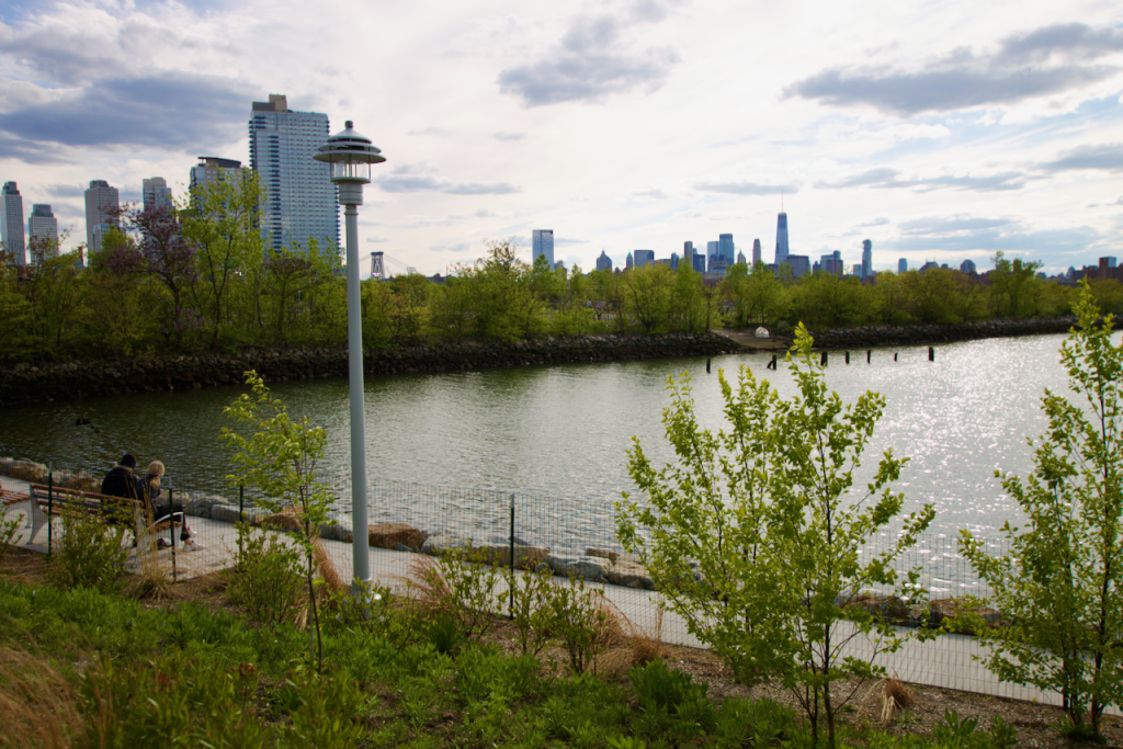
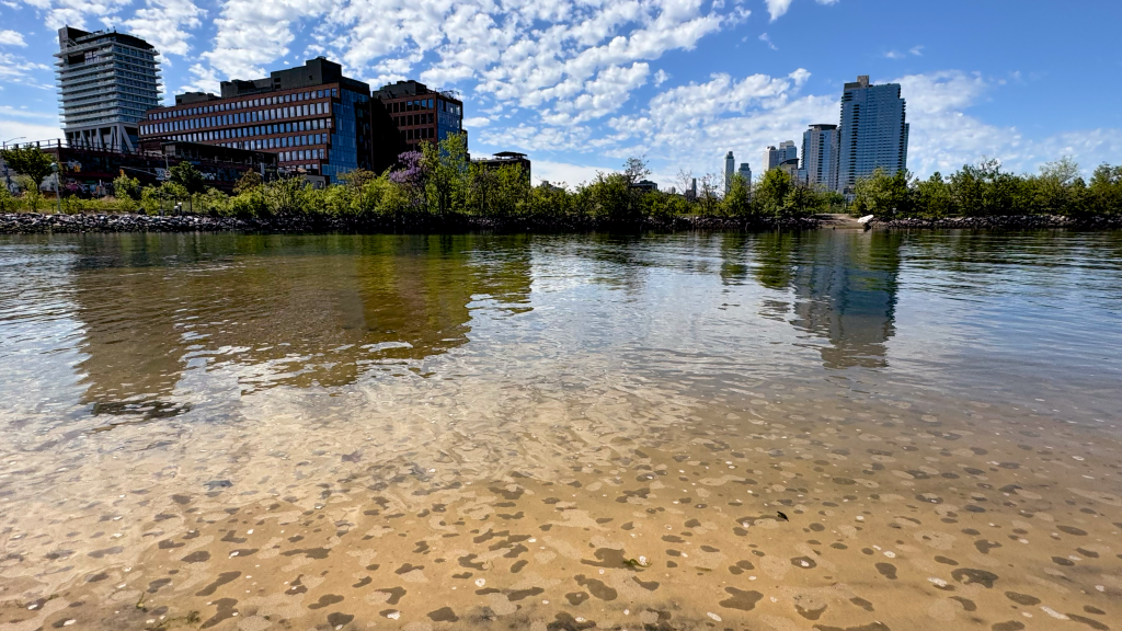
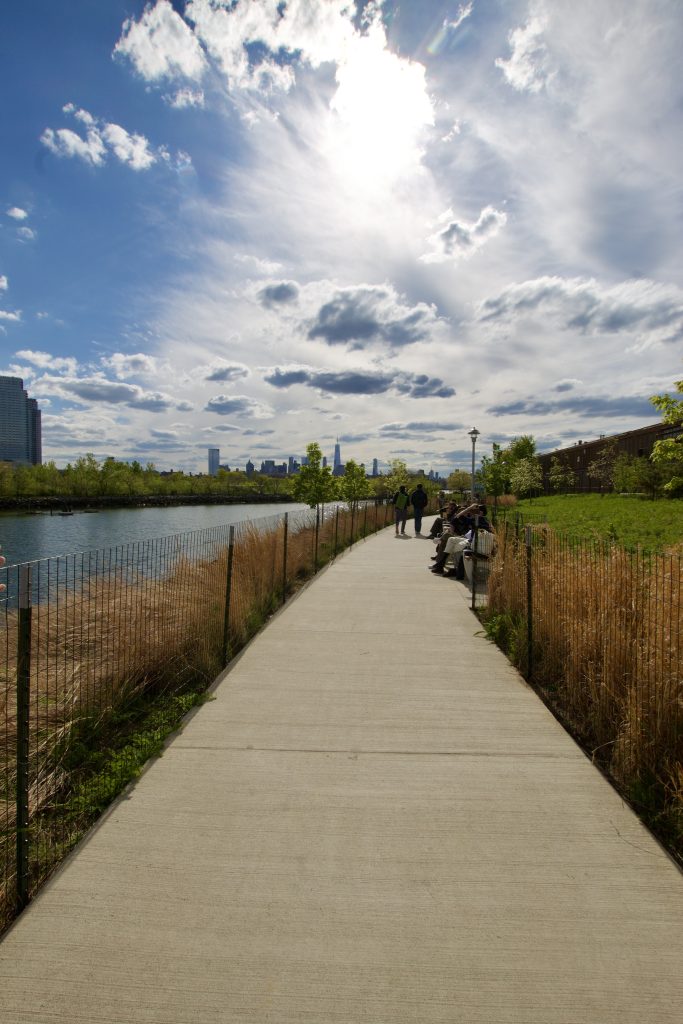
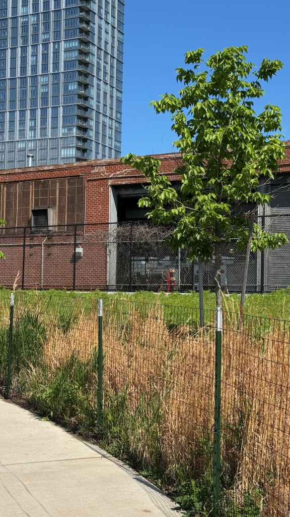

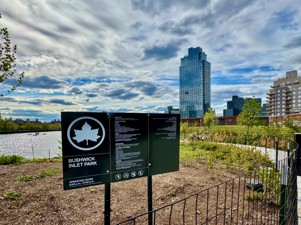
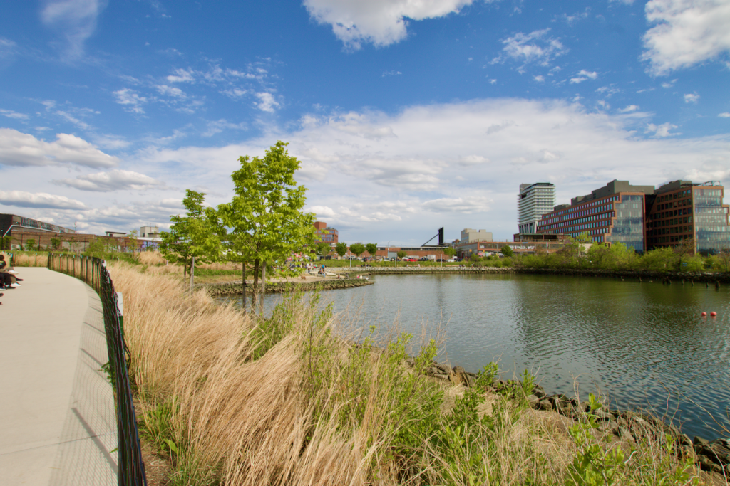
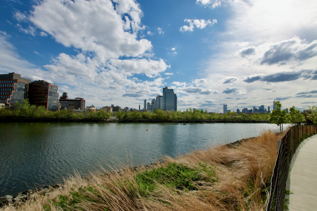
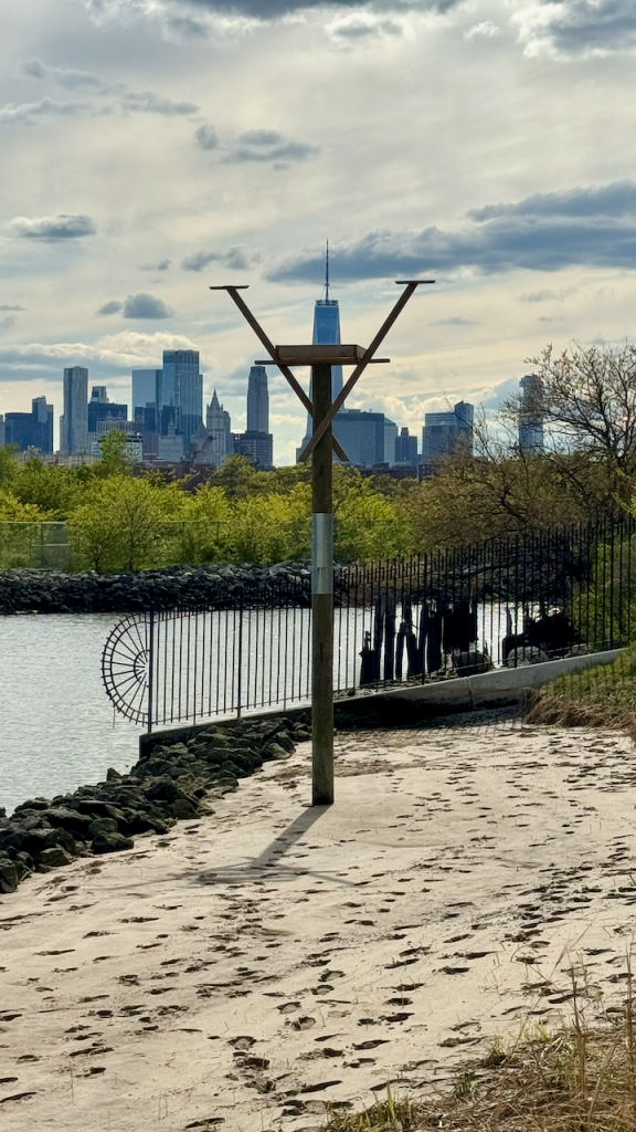
Images courtesy of Greenpoint resident, Sarah Roberts.