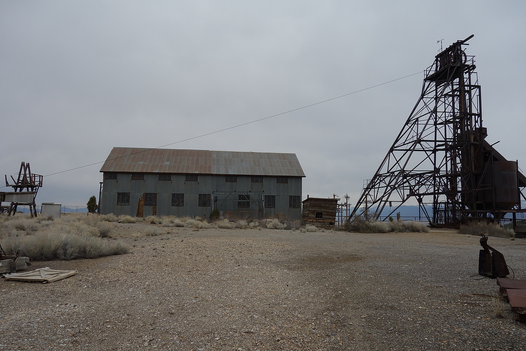
Fad shaft, Ruby Hill, Eureka Mining District, Eureka County, Nevada, USAi
| Regional Level Types | |
|---|---|
| Fad shaft | Group of Shafts |
| Ruby Hill | Hill |
| Eureka Mining District | Mining District |
| Eureka County | County |
| Nevada | State |
| USA | Country |
This page is currently not sponsored. Click here to sponsor this page.
Latitude & Longitude (WGS84):
39° 30' 19'' North , 115° 59' 7'' West
Latitude & Longitude (decimal):
Type:
Group of Shafts
Köppen climate type:
Nearest Settlements:
| Place | Population | Distance |
|---|---|---|
| Eureka | 610 (2011) | 2.3km |
Structure: Ruby Hill Thrust
Deposit: Shaft was started in 1942 by the eureka corp., no production was ever recorded. The shaft reached 2,465 feet with a number of cateral workings before it was abandoned in 1948. It is located along the northeast portion of the ruby hill area. The large amounts of water encounterred was the major problem ; info.src : 1 pub lit replacement sulfide ore
Development: Shaft begun in 1942 by eureka corp, abandoned, in 1948 due to problem of large amounts of water encountered.
Geology: The fad shaft was sunk to develop deep sulfide orebodies disclosed by diamond drilling. The drilling cut ore from 2,200 to 2,500 feet. When a crosscut was made at the 2250 foot level from the shaft. However a large in flow of water was tapped and the shaft abandoned.
Rock formation(s): Eldorado Dolomite
Select Mineral List Type
Standard Detailed Gallery Strunz Chemical ElementsCommodity List
This is a list of exploitable or exploited mineral commodities recorded at this locality.Mineral List
8 valid minerals.
Rock Types Recorded
Note: data is currently VERY limited. Please bear with us while we work towards adding this information!
Select Rock List Type
Alphabetical List Tree DiagramDetailed Mineral List:
| ⓘ Arsenopyrite Formula: FeAsS References: |
| ⓘ Calcite Formula: CaCO3 |
| ⓘ Dolomite Formula: CaMg(CO3)2 |
| ⓘ Galena Formula: PbS References: |
| ⓘ Pyrite Formula: FeS2 References: |
| ⓘ Pyrrhotite Formula: Fe1-xS |
| ⓘ Seligmannite Formula: PbCuAsS3 |
| ⓘ Sphalerite Formula: ZnS References: |
| ⓘ 'Tennantite Subgroup' Formula: Cu6(Cu4C2+2)As4S12S |
Gallery:
List of minerals arranged by Strunz 10th Edition classification
| Group 2 - Sulphides and Sulfosalts | |||
|---|---|---|---|
| ⓘ | Sphalerite | 2.CB.05a | ZnS |
| ⓘ | Pyrrhotite | 2.CC.10 | Fe1-xS |
| ⓘ | Galena | 2.CD.10 | PbS |
| ⓘ | Pyrite | 2.EB.05a | FeS2 |
| ⓘ | Arsenopyrite | 2.EB.20 | FeAsS |
| ⓘ | Seligmannite | 2.GA.50 | PbCuAsS3 |
| ⓘ | 'Tennantite Subgroup' | 2.GB.05 | Cu6(Cu4C2+2)As4S12S |
| Group 5 - Nitrates and Carbonates | |||
| ⓘ | Calcite | 5.AB.05 | CaCO3 |
| ⓘ | Dolomite | 5.AB.10 | CaMg(CO3)2 |
List of minerals for each chemical element
| C | Carbon | |
|---|---|---|
| C | ⓘ Calcite | CaCO3 |
| C | ⓘ Dolomite | CaMg(CO3)2 |
| O | Oxygen | |
| O | ⓘ Calcite | CaCO3 |
| O | ⓘ Dolomite | CaMg(CO3)2 |
| Mg | Magnesium | |
| Mg | ⓘ Dolomite | CaMg(CO3)2 |
| S | Sulfur | |
| S | ⓘ Arsenopyrite | FeAsS |
| S | ⓘ Galena | PbS |
| S | ⓘ Pyrite | FeS2 |
| S | ⓘ Pyrrhotite | Fe1-xS |
| S | ⓘ Seligmannite | PbCuAsS3 |
| S | ⓘ Sphalerite | ZnS |
| S | ⓘ Tennantite Subgroup | Cu6(Cu4C22+)As4S12S |
| Ca | Calcium | |
| Ca | ⓘ Calcite | CaCO3 |
| Ca | ⓘ Dolomite | CaMg(CO3)2 |
| Fe | Iron | |
| Fe | ⓘ Arsenopyrite | FeAsS |
| Fe | ⓘ Pyrite | FeS2 |
| Fe | ⓘ Pyrrhotite | Fe1-xS |
| Cu | Copper | |
| Cu | ⓘ Seligmannite | PbCuAsS3 |
| Cu | ⓘ Tennantite Subgroup | Cu6(Cu4C22+)As4S12S |
| Zn | Zinc | |
| Zn | ⓘ Sphalerite | ZnS |
| As | Arsenic | |
| As | ⓘ Arsenopyrite | FeAsS |
| As | ⓘ Seligmannite | PbCuAsS3 |
| As | ⓘ Tennantite Subgroup | Cu6(Cu4C22+)As4S12S |
| Pb | Lead | |
| Pb | ⓘ Galena | PbS |
| Pb | ⓘ Seligmannite | PbCuAsS3 |
Other Databases
| Link to USGS MRDS: | 10044771 |
|---|
Other Regions, Features and Areas containing this locality
North AmericaContinent
North America PlateTectonic Plate
- Antler Foreland BasinBasin
- Basin and Range BasinsBasin
- Mojave DomainDomain
- Northern Basin and RangeWide Rift
This page contains all mineral locality references listed on mindat.org. This does not claim to be a complete list. If you know of more minerals from this site, please register so you can add to our database. This locality information is for reference purposes only. You should never attempt to
visit any sites listed in mindat.org without first ensuring that you have the permission of the land and/or mineral rights holders
for access and that you are aware of all safety precautions necessary.
Fad shaft, Ruby Hill, Eureka Mining District, Eureka County, Nevada, USA